

Welcome to
Rhino Builder 3
Now with Climatological Goodness®!
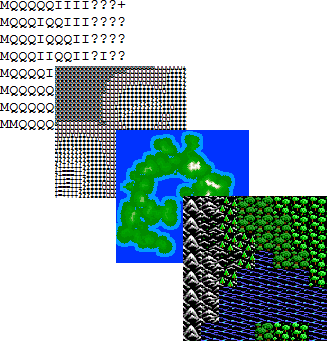
Rhino Builder 3
with Climatological Goodness®
by John Poppin
Rhino Builder is an organic game-world builder. The original versions were written mostly while riding on the Larkspur ferry to and from San Francisco. It creates a semi-random game-world map from a limited amount of user input, growing continents, mountain ranges and successive elevation levels into a world intended to look designed by geology rather than by simple random noise.
What, exactly and in plain language, does Rhino Builder do?
Rhino Builder is a game-world creation tool. You tell it roughly where you want land, how large the world should be, and what kind of terrain-generating behavior you want. It grows the physical world, lets you establish water level and geographic features, converts elevation to base terrain, then adjusts vegetation and terrain according to climate and latitude.
What is this all about?
In 2009, I decided I'd like to write an 'Ultima'-style adventure game for the iPhone platform. As the game grew in size and complexity, I realized the game-world needed to be much bigger and more natural looking, while still having a good balance for game play.
The map I had previously created was drawn in MS Paint and converted to ASCII so the characters could be loaded into an array. It worked, but it was messy and much more time-consuming than it should have been. I realized I could probably write a piece of software which, given a limited amount of input, could produce exactly the sort of map I wanted: clean and ready to use in a game. Rhino Builder grew out of that idea.
The first Rhino Builder was released in 2011. The feedback suggested that the idea was useful for more than computer games, but the interface needed polish. That led to Rhino Builder 2 and the idea of dynamically altering a generated world for climate, latitude, mountain rain shadows and lush zones.
What's 'Climatological Goodness®'?
After Rhino Builder creates a world and populates it with base-level vegetation according to altitude, it takes user input for climate and temperature and adjusts vegetation according to latitude. Cold worlds expand the polar regions and contract the tropics; hot worlds contract the polar regions and expand the tropics. Wet worlds have broader tropical regions; dry worlds have narrower ones.
Rhino Builder also creates deserts and lush zones. Mountain barriers are analyzed against the world's spin direction. The windward side receives greener, more lush terrain while the leeward side develops a rain shadow. The user-selected DESERT BREDTH determines how aggressively that dry region extends away from the mountains.
What's different in Rhino Builder 3?
Rhino Builder 2 created a three-dimensional stack of elevation layers and later flattened those layers into the final terrain map. Rhino Builder 3 stores elevation directly as a two-dimensional numeric world while keeping the final terrain layer separate. The original geology therefore remains available after vegetation and climate have been applied. This makes the generator easier to extend and will give the redesigned editor access to both what a tile is and how high it actually is.
Why JavaScript?
JavaScript is a great language for a proof-of-concept world generator. It provides nearly all of the utilitarian functionality needed for the job, and because Rhino Builder is browser-based the program can remain a self-contained collection of HTML, JavaScript and image assets.
Organic world generation? How does that work?
Each successive elevation level is grown from the terrain beneath it. Mountains, hills and slopes therefore inherit structure from earlier generation instead of being independently scattered. Water and later geographic features are then laid over that physical world. The result is still semi-random, but the randomness is constrained by the land pattern and the terrain that already exists.
So you want to play a god...
You may open and view these instructions at any time, from any point in the world-building process.
OVERVIEW
There are four active processes in this build of Rhino Builder 3:
Building - The base world is built. You designate locations and properties for land creation.
Adding Features - Water level, beaches, rivers and lava flows (if volcanoes are present) are established.
Adjusting Climate - Polar and tropical bands, and the vegetation inside them, are adjusted according to your settings. Deserts and lush zones are then created from mountain rain shadows.
Editing - The editor is intentionally being redesigned and is not included in this build.
Adding Features - Water level, beaches, rivers and lava flows (if volcanoes are present) are established.
Adjusting Climate - Polar and tropical bands, and the vegetation inside them, are adjusted according to your settings. Deserts and lush zones are then created from mountain rain shadows.
Editing - The editor is intentionally being redesigned and is not included in this build.
JUMPING IN
If this is your first time with Rhino Builder, click Create World and try the default settings. The green squares in the land-designation area are places from which land, mountains and hills will be spawned. The final land masses will follow the general pattern created there.
You can paint your own continental pattern, generate random land, or explore the presets. When you're ready, click BUILD WORLD. Rhino Builder will grow successive terrain levels and report its progress. When generation is complete, click Continue.
ADDING FEATURES
After the initial world is built you can set the water level and add beaches, lava flows and rivers. It is generally best to establish the water level first, then add shoreline features, followed by lava and rivers. You can erase the stage-two modifications and try again before committing the terrain.
When the physical world looks right, click Set Base Terrain. The map may remain geographically similar, but Rhino Builder now converts raw elevation into terrain and vegetation bands. Rhino Builder 3 keeps the original elevation array intact underneath this terrain layer.
CLIMATOLOGICAL GOODNESS
Climate science is complex, so Rhino Builder deliberately reduces it to four sets of controls:
SPIN - Sets the prevailing east/west direction used by the mountain rain-shadow system.
CLIMATE - Wet broadens the tropical region; Dry contracts it; Medium leaves the normal tropical bands in place.
TEMPERATURE - Cold expands the polar regions and contracts the tropics. Hot contracts the polar regions and expands the tropics. Temperate uses the normal latitude bands.
DESERT BREDTH - Ankles, Waist and Neck determine how far a rain shadow can extend beyond mountain barriers.
CLIMATE - Wet broadens the tropical region; Dry contracts it; Medium leaves the normal tropical bands in place.
TEMPERATURE - Cold expands the polar regions and contracts the tropics. Hot contracts the polar regions and expands the tropics. Temperate uses the normal latitude bands.
DESERT BREDTH - Ankles, Waist and Neck determine how far a rain shadow can extend beyond mountain barriers.
Click Add Climatological Goodness to apply the latitude-based terrain conversion. The polar and tropical boundaries contain narrow variance bands, so the edges are irregular rather than perfectly straight lines across the world. Existing terrain type is also preserved conceptually: mountains remain mountains, while forests, scrub and grass are converted into appropriate polar or tropical counterparts.
Once climate has been applied, click Create Deserts. Rhino Builder uses mountain barriers and the selected spin direction to create greener windward terrain and drier leeward terrain. Desert creation can take longer on very large worlds.
Reset Climate restores the base terrain so you can try different settings without rebuilding the physical world.
The editor and final map export/save system will be added after the new editor design is settled.
| Beach Density | % | ||
| Tiles Deep | |||
| River / Lava Width | Regular | ||
| Wide | |||
| Lava Curvyness | % Curvy | ||
| Flows | |||
| River Curvyness | % Curvy | ||
| Rivers | |||
SPIN:
West to East

(Normal)
East to West

CLIMATE:
Wet
Medium
Dry
TEMPERATURE:
Cold
Temperate
Hot
DESERT BREDTH:
Ankles
Waist
Neck
Selected terrain:
Grass
Brush Size:
1
Viewport
X: 1 Y: 1
Use the scroll bars beside and below the editor to move around the world. Click a terrain tile to select it, then click or drag on the map to paint. The red box shows the current 41 x 41 editing window.
| PRESETS: |
|
|